![]()
|
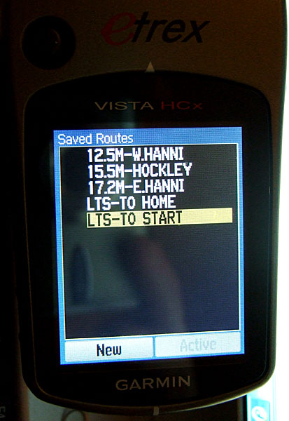
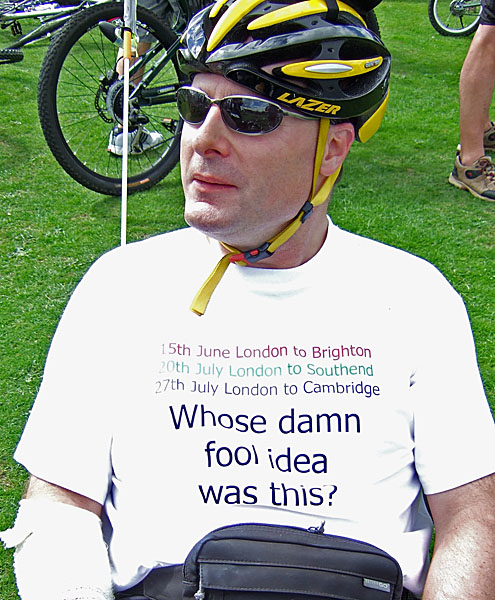
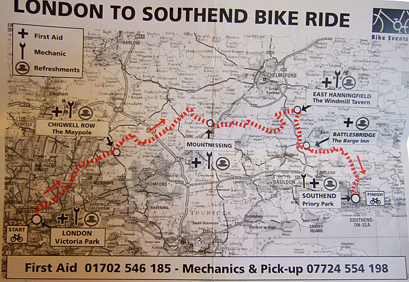
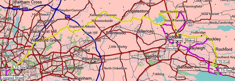
I'd originally signed up to all three of the big rides (London to Brighton, London to Southend and London to Cambridge) on the basis that my business travel schedule is unpredictable, and by registering for all three, I'd be reasonably sure of being around to do at least one of them. As things worked out, I was able to do two. Since I live reasonably close to Southend, my plan for this ride was to cycle to my local train station (2 miles), take the train into London, cycle to the start (4 miles), do the ride itself (55 miles) and then cycle home afterwards via the seafront (13 miles) - for a total of 74 miles. I plotted routes to the start and home from the finish, and uploaded them to my GPS:
Perhaps one day I'll feel sufficiently comfortable doing these distance rides that I'll take my time, carry an SLR and take some proper photos en-route. But as that day has not yet arrived, you'll have to settle for some hastily-grabbed snaps taken with a pocket camera. :-) Sod's law was in operation: I checked all the fasteners the day before the ride then did a test-ride, and all was well. I then nipped off to the shops on the trike and a mudguard fastener promptly fell off and was lost! This meant doing the ride without mudguards. The Accuweather, BBC and Met Office forecasts all disagreed, but the worst case was light showers, so I had to hope for the best. I'm not a morning person, so had originally booked myself onto the 0915 start-time. Congestion on the London to Brighton ride suggested that getting away a little earlier would be a good idea, so my plan was to blag my way through the 0830 start-gate. Since there was only 3,000 riders on this one (rather than the 27,000 on the LTB), I didn't expect this to be a problem. It did, however, mean being bathed, dressed and out of the house at a time I do not usually encounter on a Sunday morning:
I'd prepared everything the previous evening, so all I had to do in the morning was fill my water bottle and set off. As I say, mornings and I have only a passing aquaintance, but on the rare occasions when our paths cross, I do enjoy the deliciously smug feeling you get from being out & about at this sort of time on a Sunday. |
|
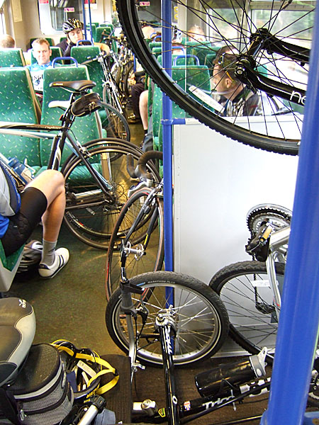
A quick ride to the station, and on board the 07:05. I was fortunate in that I was joining the train early enough in its journey that there was space for my bike, but two stops later there were one or two bikes on board.
The upright bike on the right is being held in that position by its owner because there was nowhere else it could go. I was being joined by a fellow TRICE ride, Daren, who was originally planning to join the train at Gidea Park. I called him to warn him that space was tricky, and he managed to catch an earlier train. The ride started from Victoria Park in Hackney. My closest station to the start was Stratford, but that would have meant carrying a very heavy trike down a long flight of stairs (it doesn't fit in the lift), so I stayed on into Liverpool Street. The train was delayed due to the large number of cyclists joining at each stop, and of course almost the entire train-load disembarking at Stratford. This left us running a little late. I met Daren at Liverpool Street, and from there it was a 4.3-mile ride to the park.
We stopped off in Brick Lane for bagels and pastries to eat at lunchtime - a top idea on Daren's part. Some people like to dress up in various weird and wonderful costumes, but I didn't want to be in anything warmer than a t-shirt. I did, though, try to enter into the spirit of things:
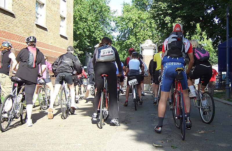
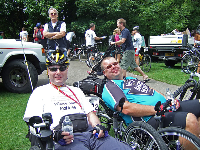
Daren was wearing a Heinz Baked Beans t-shirt which I forgot to photograph at the start, but you'll see it later. Here he is as we set off from the start - does he look nervous to you? |
|
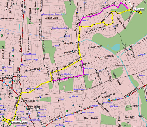
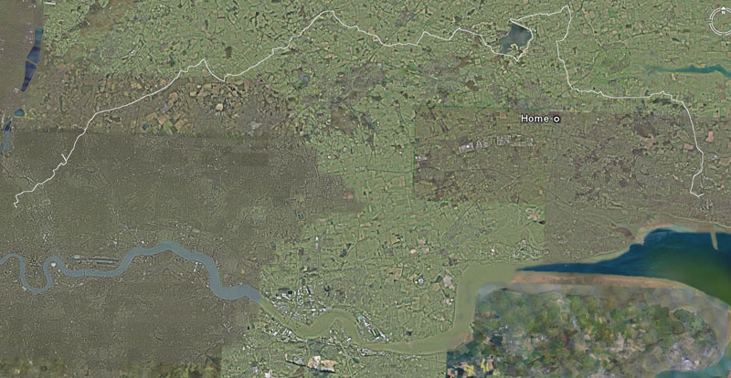
I had fond visions of the route being flatter than London to Brighton, though as part of the route duplicates one of my local cycle routes, I did know about the hills around East Hanningfield! In fact, at one point (Battlesbridge), the route was going to pass within a couple of miles of my home. |
|
The LTS ride is a lot smaller than LTB, and as anticipated, an earlier start-time was not a problem. The limited numbers also enabled them to hold us in batches of around 30 riders to give us the full 5-4-3-2-1-Go treatment. We passed through the start gate at 08:41. |
|
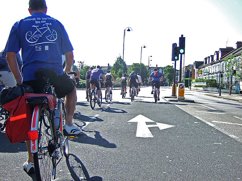
On the LTB, it took two hours to do the first 10 miles due to the congestion. Things were a little different this time! |
|
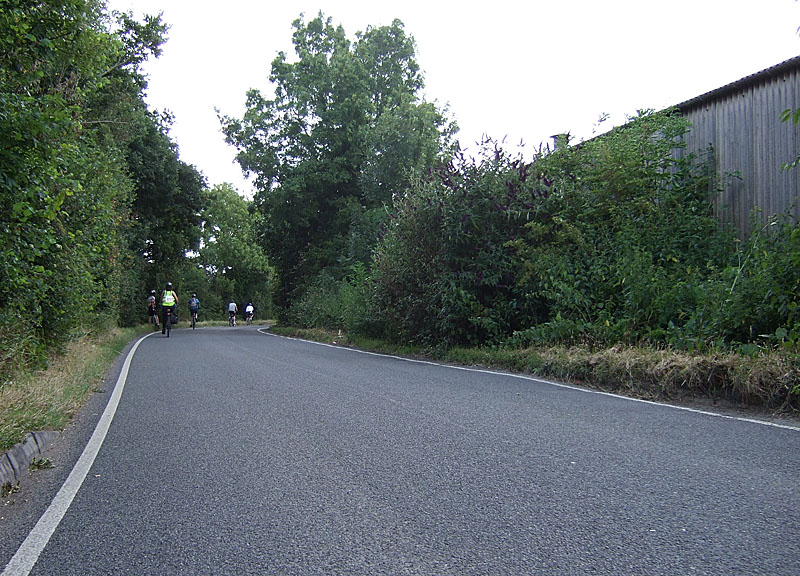
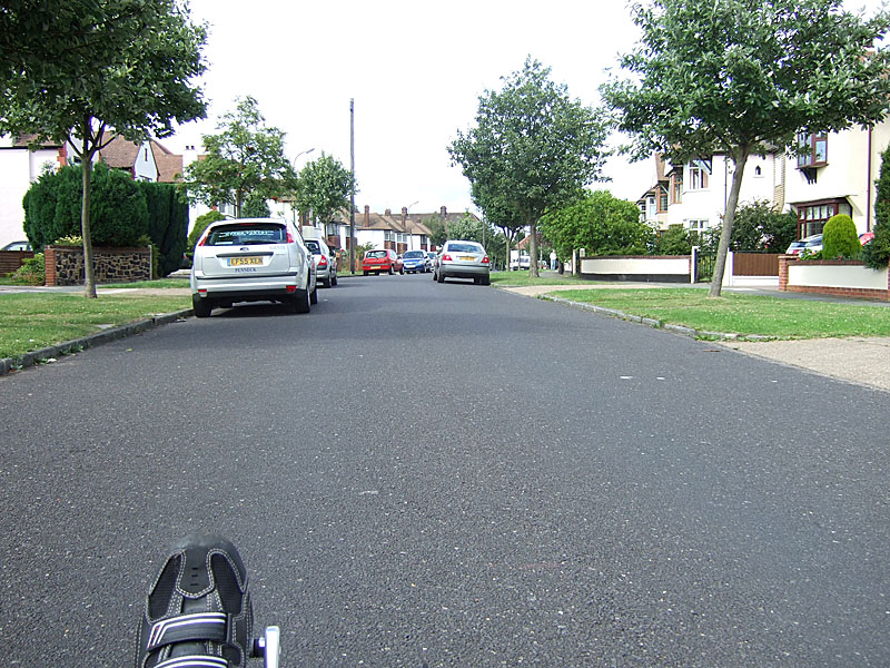
In fact, there were so few riders on some stretches that at one point Daren and I (who had been first away from the lights) took a wrong turn and had to backtrack a bit. We were quickly out into Essex, where congestion levels mostly looked like this: |
|
And sometimes even like this: |
|
The first refreshment break was at a pub in Chigwell. We only stopped long enough for me to refill my water bottle (Daren has a Camelbak which lives in his mesh seat, provoking waterbed comments), and off we went again. Our first proper stop was at Mountnessing Windmill, which we reached at 11:02: |
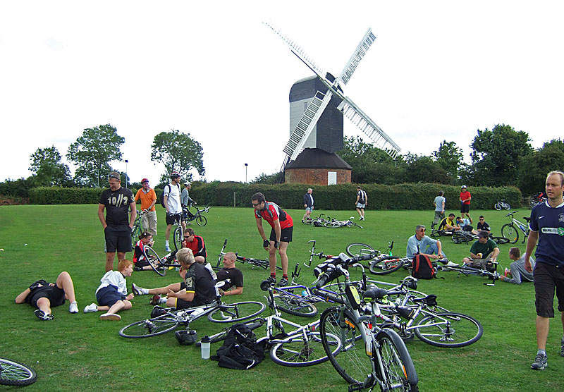
|
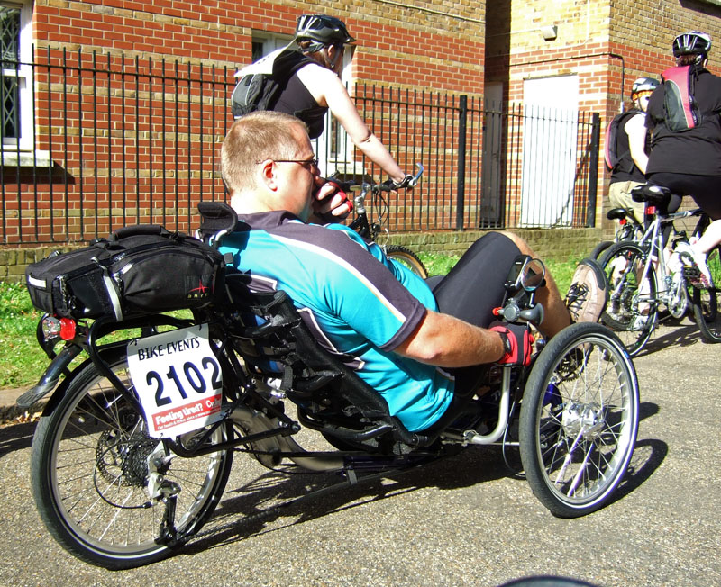
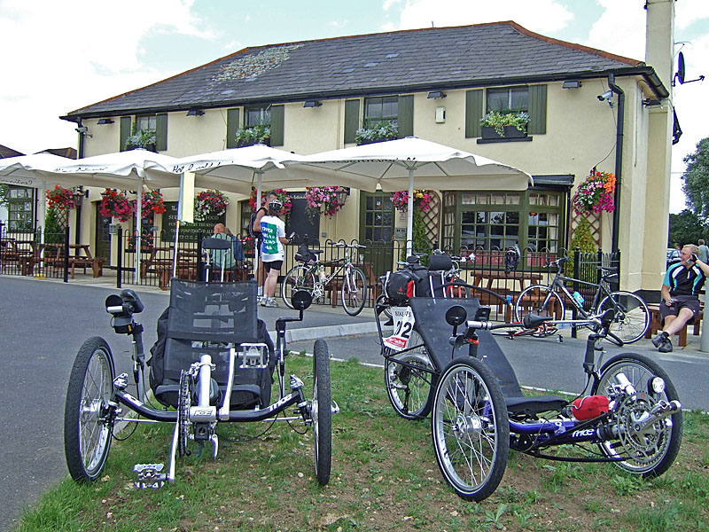
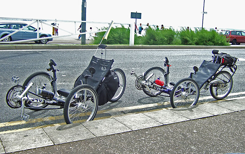
We'd met up with another TRICE Q rider en-route, so we naturally needed to take the trio of TRICES photo (we decided the collective noun is a grin of TRICES). This photo also shows That T-shirt: |
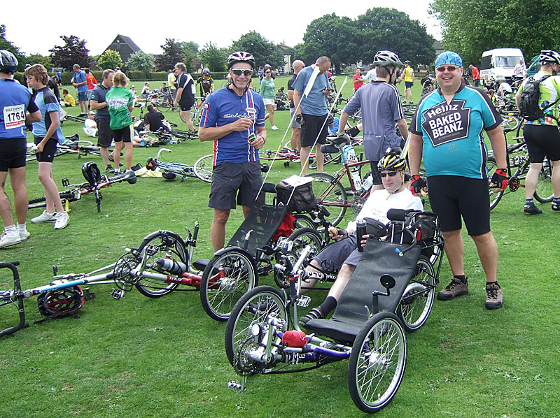
|
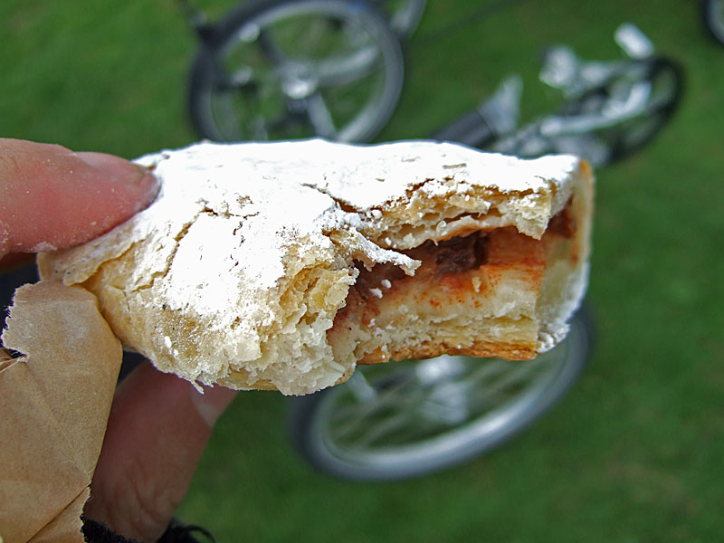
The third chap in the photo isn't actually the rider, rather a friend of the rider. The actual rider, Will, was filling his water-bottle at that point. I'm not sure what age he was, but he had grey hair and was leaving us for dead up the hills. I felt less bad about this when I learned that he had ridden the entire Tour de France route: 2700 miles! He took three months to do it, of which there were 60 riding days. Although it was rather early, I was starving by this point, so I polished off both my bagel and the absolutely delicious pastry: |
|
Then it was back on the road. We were extremely fortunate with the weather: dry, sunny, not too hot - and (an absolute bloody miracle, this one) a decent tail-wind! However, we did encounter a head-wind at one point, so I decided to find out whether it was possible to draft a TRICE. (For non-cyclists, drafting is when you get close enough to one or more cyclists ahead that they shelter you from the wind.) The good news is: it is! You do, though, have to stay very close: |
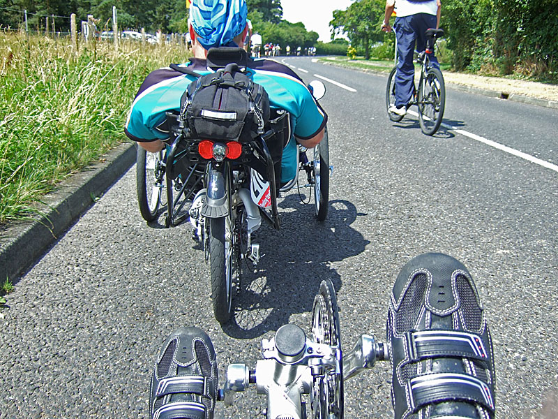
|
Even dropping back a foot from this position loses the effect. We were onto my local roads for the next stretch, so I knew exactly where I was. Fortunately I was enjoying myself and in no discomfort, so no temptation to slope off home! I had rather a close call when a large blue lorry decided to reduce his journey time by half a second by cutting a blind bend, presumably on the 'I know this road and there's never anything coming the other way' principle. Fortunately I was tucked in tight to the verge, but he came within about a foot of me at the closest point. The many hundreds of oncoming cyclists he must already have passes on that road seemingly didn't give him any clue that the road was, in fact, not empty. We skipped the East Hanningfield stop, but a bit further on discovered what I suspect was actually a clever ruse by a pub landlord to drum up business. It was pointed out by an apparent marshall (a guy in a hi-vis vest), but didn't appear on the route-map! They also didn't seem well setup for refilling water-bottles, so methinks this was an enterprising landlord dressing one of his staff in a hi-vis vest and sending them out onto the road. Top marks for entrepreneurial spirit if so! :-) Official or not, it provided an opportunity for another TRICE pic: |
|
I started my GPS at Liverpool Street, so mileages include the 4 miles from there (and exclude the 2 miles from home). So really we were 41 miles into the 55-mile ride: |
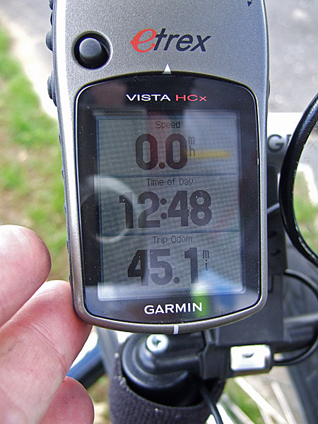
|
We were feeling pretty pleased with our progress. The following stretch was the worst part of the route. A pathetically-short cycle-path dumped us onto a fast and fairly busy A-road. I switched on my Dinotte amber running light in strobe mode. The rest of the run into Southend was pretty urban, but I suspect there simply isn't a quiet way in that would be suitable for large numbers of cyclists. Various people throughout the ride had been spotting my GPS and asking me how much further to go. The last person to ask was cheered by my reply: "Less than a mile." Disappointingly, the ride didn't end at the sea-front, as would have been right and proper, but in a park a few miles from the sea-front. Still, we could correct that shortly, and in the meantime we had that delicously smug feeling you get when you see this in front of you: |
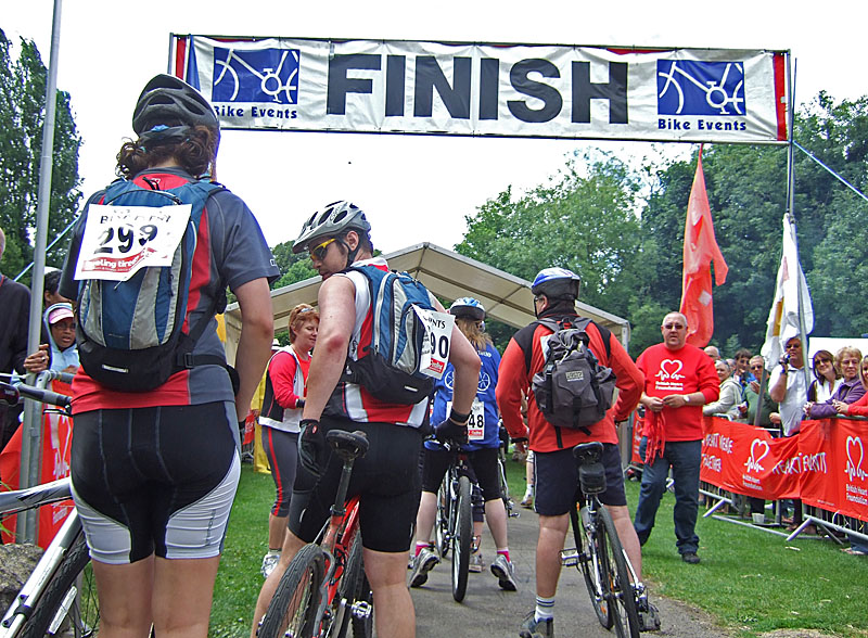
|
There were fairly large crowds lining the finish lane, and a commentator was passing comment on the various riders of note. Unsurprisingly, the appearance of two recumbent trikes got a mention; surprisingly, he was very well-informed about them, advising the crowd that they were slow uphill but fast downhill, and extremely comfortable. Daren's t-shirt got a mention too, with the suggestion that if he were powered by beans, it would be advisable not to follow him too closely. Two TRICE riders looking pretty pleased with themselves on the far side of the finish area: |
|
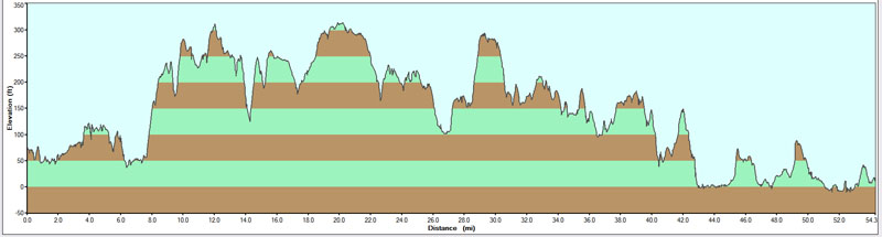
Here's the map and altitude profile: |
|
The final stats for the ride were these (ignore 'Area' - it doesn't mean anything): |
![]()
|
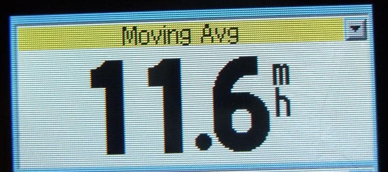
The average speed shown includes rest-stops. Mapsource is fantastic software for plotting routes, but less good for analysis. Getting the moving average requires asking the GPS: |
|
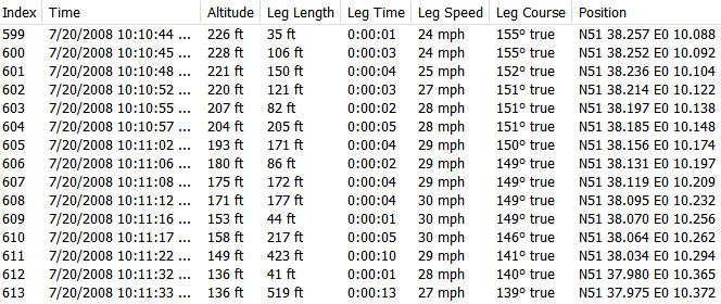
In reality, we would have been a little faster than this (I think Daren's GPS reported around 12mph) as that includes my ride home, which was into a headwind. As you can see from the altitude profile, most of the hills were short, but some were steep: |
|
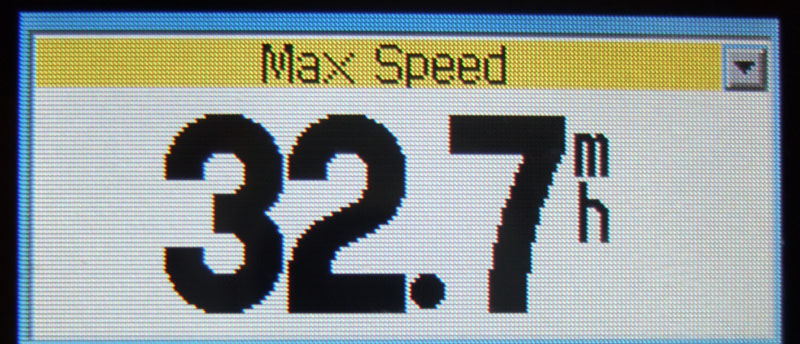
Sadly, short uphills means no mega downhills either, so I wasn't going to be setting a new personal best top speed today. There were, though, quite a few enjoyably brisk downhills: |
|
It was notable that while we may possibly have been overtaken by one or two <cough> bikes uphill, nothing ever overtook us on the downhills. My maximum speed was, though, quite modest: |
|
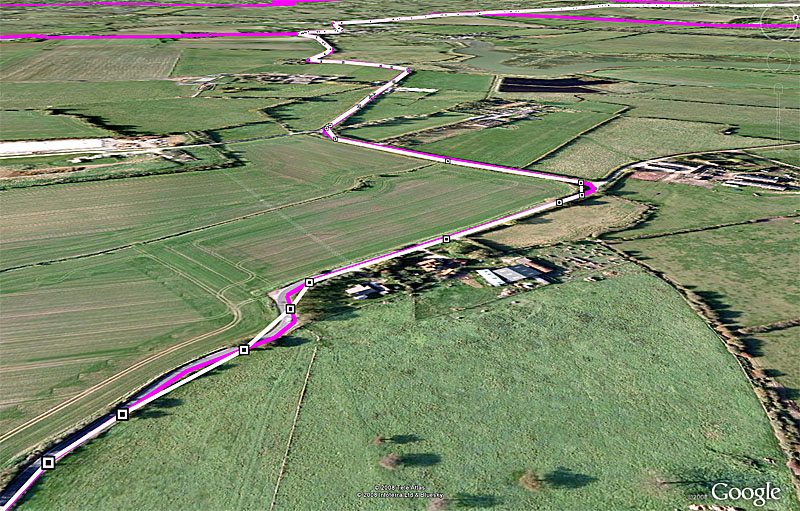
Incidentally, for those GPS sceptics who can't see the point in them and have no interest in this sort of data, another great thing about them is, when you've done an organised ride, you can view your tracklog in Google Earth to remind yourself of the sections you'd like to repeat another time. |
|
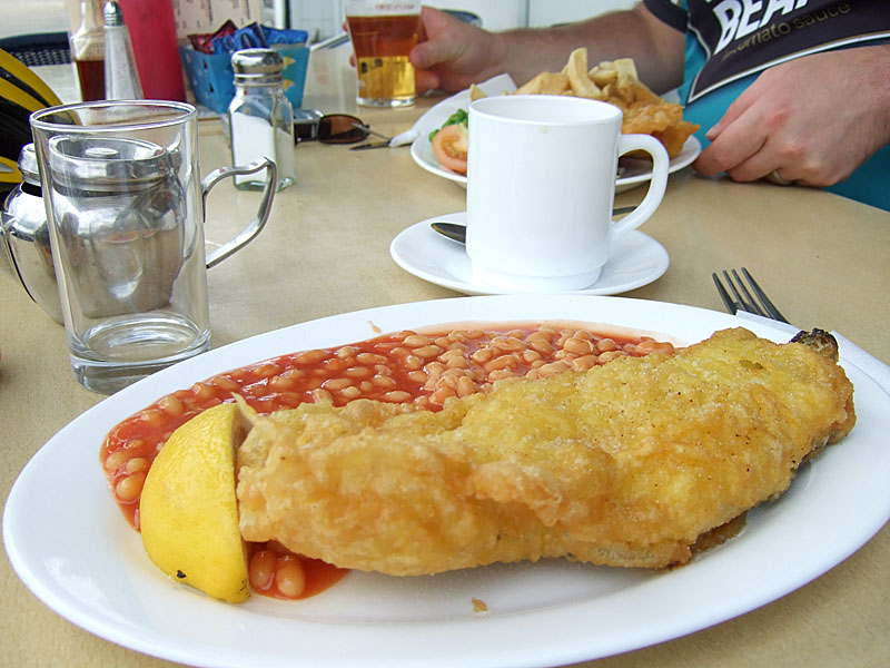
After a short rest at the park (where I think we sold three more TRICES - I really must get ICE to put me on a commission), we finished the ride in the approved fashion by cycling down to the sea-front and parking outside the first fish-and-chip cafe we found. :-) |
|
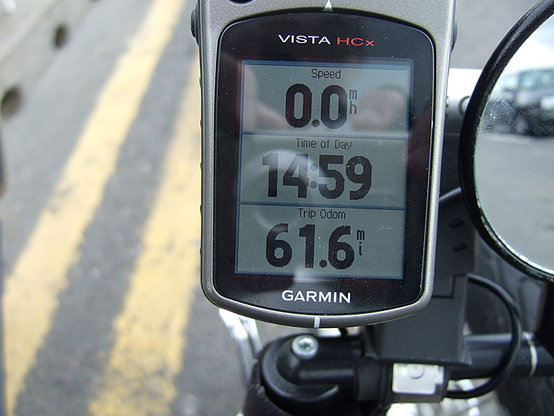
By that point, our total mileage from Liverpool Street was 61.6 miles: |
|
One great thing about these rides is guilt-free calories! |
|
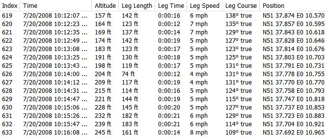
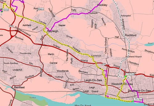
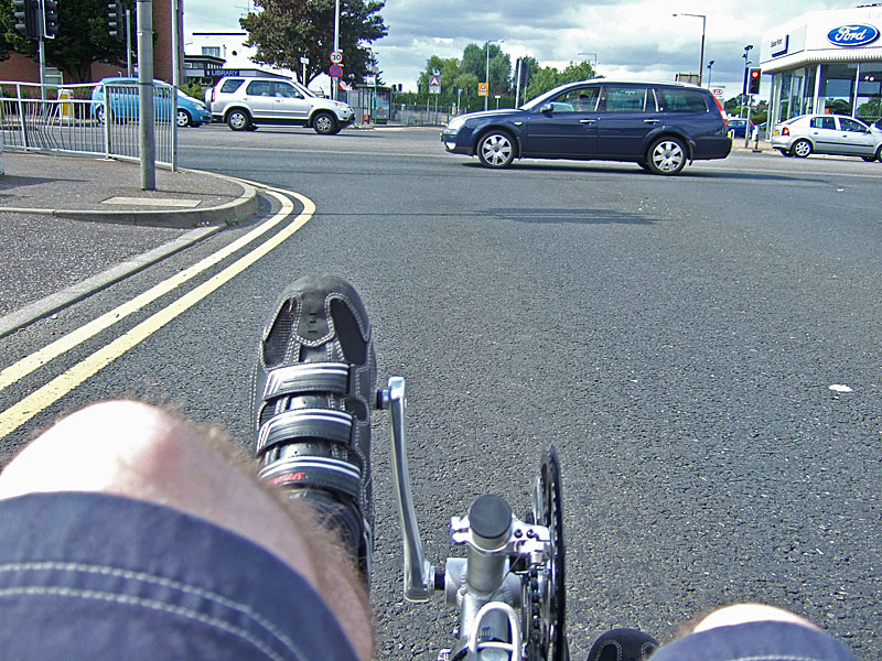
Which I followed with cherry pie and ice-cream. :-) I'd decided to see how I felt at the end of the ride, taking the train home if I was tired and riding home if not. Fortified by my rations, I felt fine for the ride home, even if it was now into a stiff headwind. I'd pre-programmed a route home along quiet roads: residential roads out of Southend, then a reasonable semi-rural road the rest of the way: |
|
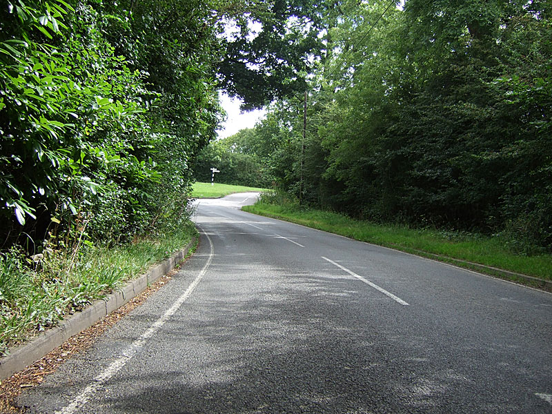
Those quiet roads out of Southend: |
|
And the only time I saw the busy A127 was crossing it: |
|
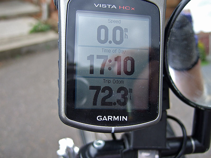
With the headwind, and perhaps a bit less energy than at the start of the day, this final leg of the journey was a little slower: |
![]()
|
And that was the day! To the mileage shown below, we need to add the two-mile ride to the station for a total of 74.3 miles. :-) This was 2.1 miles longer than my total for the LTB. |
|
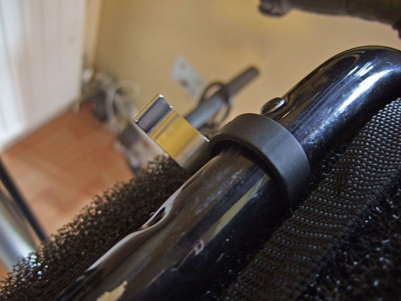
Perfect weather, no aches or pains, and no mechanical problems until the very end! When I picked up the trike to take it indoors, the front of the seat came loose. Again, quick-release fasteners about which I'm growing increasingly sceptical: |
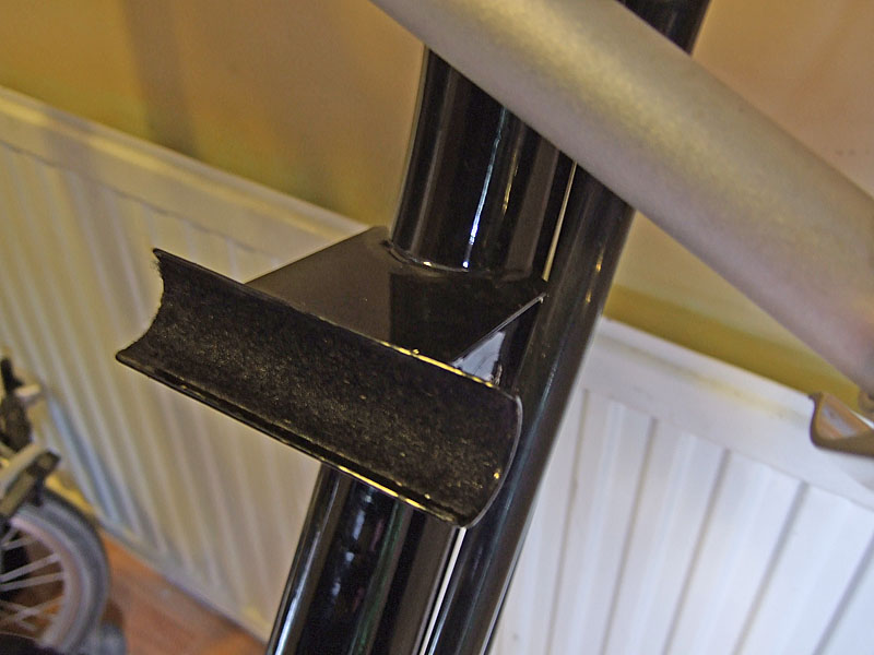
|
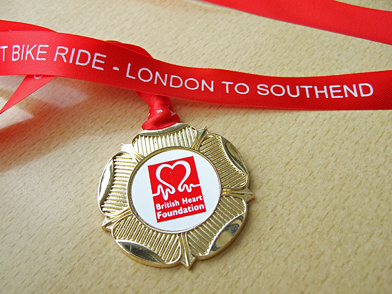
I think I will investigate alternatives there. So, another tacky plastic medal to add to the collection: |
|
I did the ride again in 2009. Same route, stiff headwind for the last 10 miles, but still great fun. If you'd like to ride the route yourself, you can download the tracklog below. If you have a Garmin GPS with Mapsource, then the .gdb file is the one you want; for anything else, the .gpx file is the universal exchange format so any GPS worth its salt should be able to read that. |
![]()